Course Overview
Explore the fundamental principles and advanced techniques of seismic methods in geophysical site investigations through TAQELL’s comprehensive course on Geophysical – Seismic Methods of Site Investigation. This course is designed to equip participants with essential knowledge and practical skills necessary for effective seismic data acquisition, processing, and interpretation.
Course Content
a. Basics of Seismic Methods
To gain a foundational understanding of seismic methods used in geophysical investigations, it’s essential to explore various types of seismic waves and their applications. Seismic waves, including compressional (P-waves) and shear (S-waves), play crucial roles in imaging subsurface structures and identifying geological features. Understanding the equipment used and the basic principles of data acquisition are integral parts of mastering seismic techniques, which are pivotal in fields such as oil exploration, earthquake studies, and civil engineering for assessing ground conditions
b. Fundamentals of Wave Propagation
Studying the physics behind wave propagation through various geological materials involves delving into how seismic waves navigate and interact with different types of rock and soil. This exploration helps in understanding the behavior of seismic waves like P-waves, S-waves, and surface waves, each with distinct characteristics influencing their travel paths and speed through the Earth. Geological properties such as density, porosity, and stiffness profoundly impact wave velocity and amplitude, critical factors in seismic studies determining subsurface structure and material composition.
c. Seismic Refraction Survey
Seismic refraction methods are extensively used for subsurface investigation, involving a detailed exploration of planning, design, data acquisition techniques, equipment setup, processing, and interpretation of seismic refraction data. These surveys are meticulously planned to determine subsurface velocity profiles and geological layering. The process begins with careful design to ensure optimal coverage and accuracy, followed by precise data acquisition using seismic sources and geophones. After data collection, sophisticated processing techniques are employed to analyze arrival times and velocities of refracted waves, which are then interpreted to map subsurface structures, depths, and material boundaries. This comprehensive approach facilitates robust geotechnical and engineering assessments essential for various construction and environmental
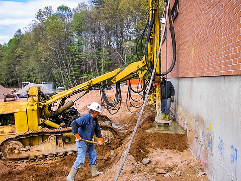
d. Borehole Seismic Methods
Borehole seismic techniques, such as Vertical Seismic Profiling (VSP) and Crosshole Seismic Testing, offer detailed subsurface characterization by deploying seismic sources and receivers in boreholes. VSP involves placing geophones in a borehole while inducing seismic waves either at the surface or in nearby boreholes, capturing reflections and refractions for precise imaging. Crosshole Seismic Testing employs sources and receivers in different boreholes to measure wave travel times and velocities, revealing subsurface properties like lithology and geological structures.
Data collection requires accurate positioning of equipment and precise timing to record wave responses effectively. Analysis involves processing recorded data to derive velocity profiles and interpret subsurface features such as interfaces and anomalies. These techniques are essential in diverse applications such as reservoir characterization in oil and gas exploration, geotechnical assessments for infrastructure projects, and environmental studies for groundwater evaluation and contamination mapping. Their ability to provide high-resolution subsurface images makes them indispensable in geological and engineering investigations.
e. Multi-channel Analysis of Spectral Waves (MASW)
The Multichannel Analysis of Surface Waves (MASW) method is a surface wave technique used for subsurface investigation. It involves designing surveys with strategically placed geophones and seismic sources to capture wave dispersion characteristics across different frequencies. Data acquisition focuses on collecting accurate seismic data to analyze wave propagation. Spectral analysis and inversion techniques are then applied to derive shear wave velocity profiles from dispersion curves. MASW results help delineate subsurface features like soil layers, bedrock depth, and potential geohazards, making it valuable for construction site characterization and seismic hazard assessment.
Learning Outcomes
Upon completion of the course, participants will:
• Understand the fundamental principles of seismic methods and wave propagation.
• Be proficient in planning, executing, and interpreting seismic refraction surveys.
• Acquire skills in borehole seismic methods and MASW for detailed subsurface characterization.
• Gain practical insights into the application of seismic techniques in geotechnical engineering, environmental studies, and infrastructure development.
Course Format
• Online: Flexible learning suitable for remote participants.
• Offline: Hands-on training with access to specialized equipment and field exercises.
Who Should Attend?
• Geophysicists, geologists, and civil engineers involved in site investigations.
• Professionals working in infrastructure development, environmental consulting, and resource exploration.
• Students and researchers in geophysics, geology, and related disciplines